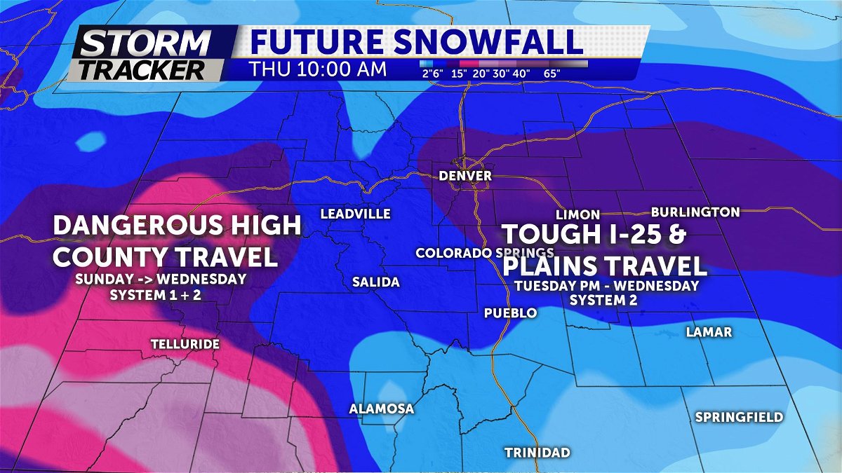
Several storm chances this week
TONIGHT: Mostly cloudy conditions are expected tonight, which will keep temperatures about 10 degrees above average. Lows will stay in the mid to upper 20s. Snow begins to push towards the continental divide overnight, with the chance of a spillover shower by Sunday afternoon.
TOMORROW: Temperatures will cool off, reaching the 50s along the I-25 corridor and perhaps low 60s for portions of the Plains. A quick burst of snow is expected to impact the Pikes Peak Region in the afternoon, but little if any snow is expected to accumulate.
EXTENDED: A stretch of unsettled weather for the mountains will begin with periods of snow through the middle of next week. Temperatures will be cooler next week for southern Colorado, with the chance for some light to moderate snow Tuesday and Wednesday. Highs will also cool into the 30s and 40s.