Snowy and cold start to weekend
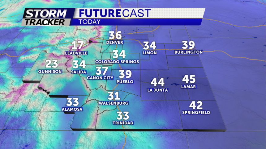
Saturday: Any leftover snow south of the Arkansas River should end early. Expect a blustery day with wind gusts between 20 and 40 mph over the Palmer Divide and the eastern plains. The wind shouldn't be as gusty along and west of I-25 in other areas, but for many areas there will be enough wind to put a bite into the air. Clouds should generally break up from northwest to southeast as the day progresses, but high temperatures are only expected to reach the 30s and 40s for most areas with some 20s over the mountains.
Extended: Sunday will start chilly but should end up warmer during the afternoon with high temperatures rebounding into the 40s and 50s for the plains with some 30s over the mountains. We expect some afternoon clouds and areas of wind, so "brisk" is probably a good word to describe the day for most areas. Next week will be colder than last week with periods of wind and high temperatures mostly in the 40s and 50s for the plains with 30s and 40s over the mountains. A weak system should bring some clouds over much of the area and possibly a few snow showers to the high country on Tuesday, but we don't expect any significant precipitation over the plains. A separate system could bring some rain and/or snow showers to mostly far southern and eastern Colorado later in the week.
