WEATHER ALERT: Heavier Snow Wednesday
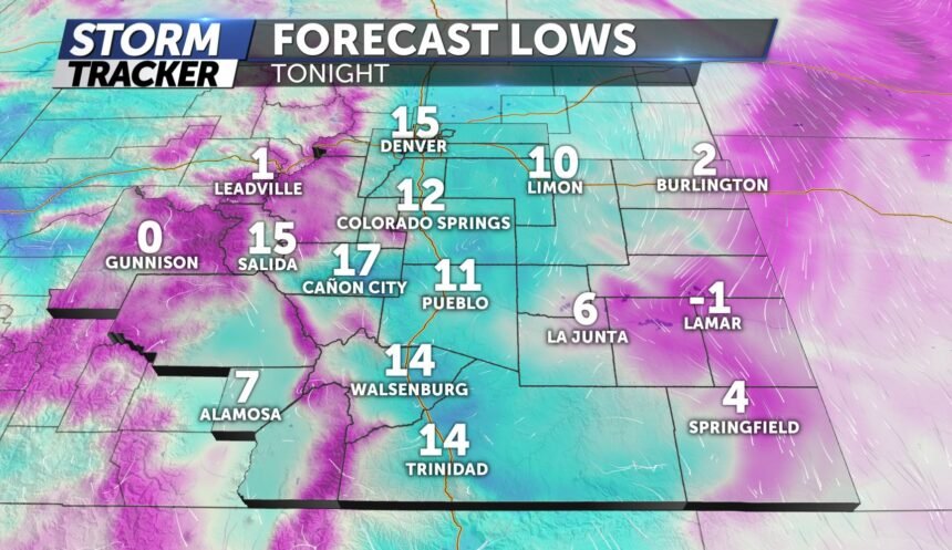
TONIGHT: Partly cloudy and cold with isolated snow showers. Snow tapers off around 8pm for the Pikes Peak region and closer to 10pm for the southern Moutnains. The cold morning starts will continue with lows in the teens Wednesday.
TOMORROW: cloudy skies and temps in the 20's and 30's with the first half of the day keeping dry. Snow develops after the noon hour and lingers into the overnight. 2-5" of snow possible along and west of I-25 will be likely by Thursday morning. A general 1-3" for Pueblo. Higher terrain areas could see up to 6 inches.
EXTENDED: Clearing skies on Thursday and a warming trend returns through the weekend. We'll see temperatures warm into the upper-40s and low-50s this weekend.
