COLD FRONT TONIGHT

TONIGHT: Cold front sweeps across the state later tonight which will trigger a few round of light flurries around the Pikes Peak region. Light accum possible and mainly around higher terrain areas where a general T-2". Most areas will keep dry.
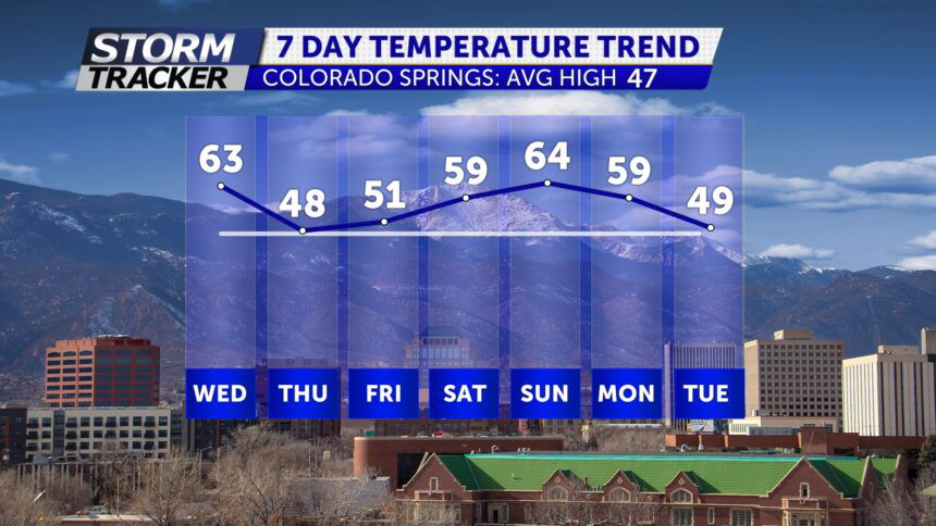
TOMORROW: Partly cloudy and cooler with highs in the 30's and 40's. Periods of rain/snow possible with additional light accumulation of snow mainly on grassy surfaces.
EXTENDED: High pressure builds back across the area this weekend with warming temperatures back into the 50's and 60's by Saturday and Sunday.
