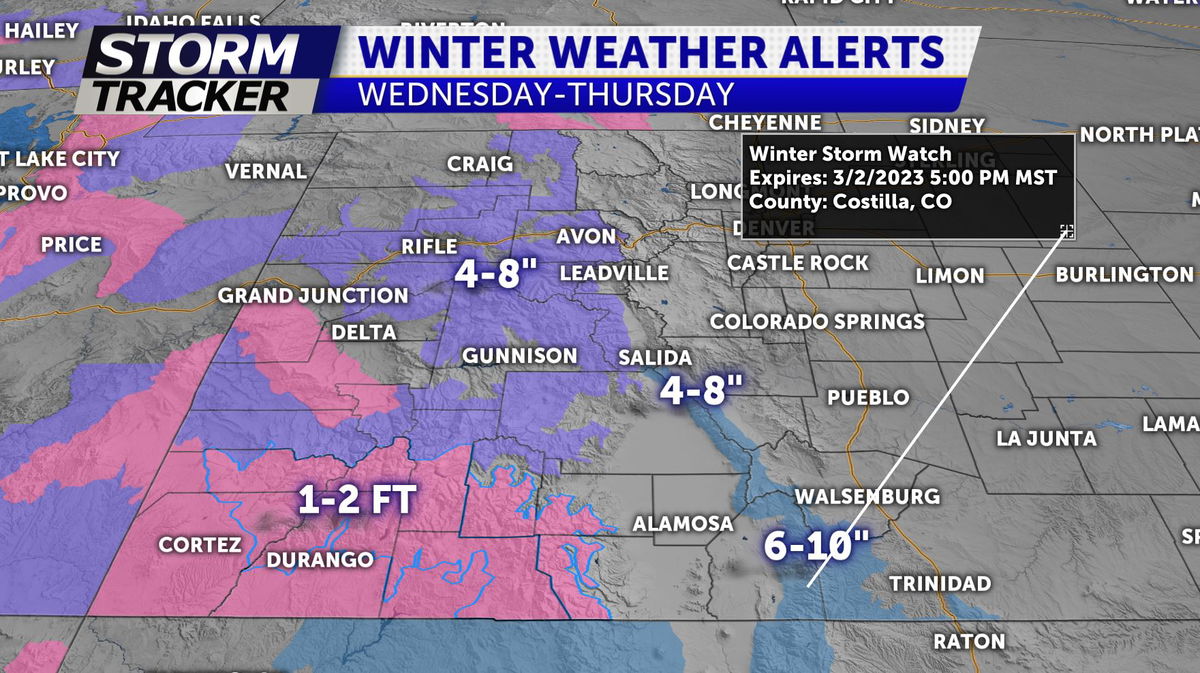
SNOW CHANCES WEDNESDAY EVENING

TONIGHT: Partly cloudy and chilly overnight with lows in the low-20s.
TOMORROW: Increasing cloud cover Wednesday afternoon with highs in the 40s. Snow will move into the area overnight... and roads may be slick in some places for the Thursday morning commute. Currently high end amounts look close to 1-3" around Pikes Peak region.. with higher amounts south of Highway 50 with a general 2-5" possible. Forecast amounts are highly subject to change... depending on the final track of this system.
MOUNTAIN SNOW: More snow for the high country by Wednesday morning-afternoon before a heavier surge of snow moves in for the southern Sangre De Cristos by midnight Thursday through Thursday afternoon
EXTENDED: Clearing skies Thursday night with colder overnight lows in the single digits. Partial sunshine Friday before a chance of snow returns Friday night