Active Weather Week Ahead
TONIGHT: Clouds hold off overnight tonight, with lows in the upper teens and 20s. Snow will begin to creep into the region early Monday morning.
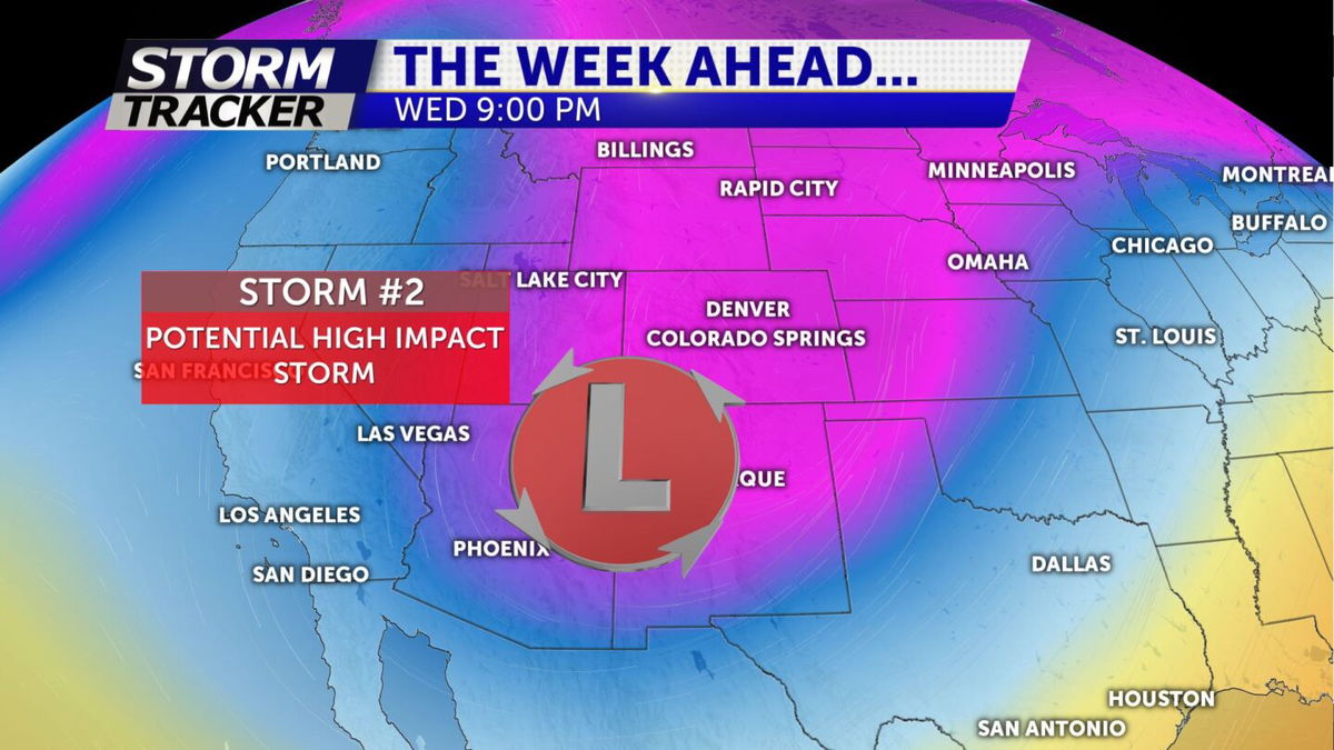
MONDAY: Two storms are expected this week. The first arrives tonight, with snow spreading across the San Juan Mountains, where a general seven to twelve inches is expected. A quick burst of rain and snow is expected along the I-25 corridor just in time for rush hour. Little to no accumulations are expected. Otherwise, we stay mild with temperatures again in the mid to upper 50s across the region.
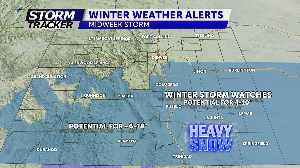
MIDWEEK STORM: By the middle of the week, we're tracking a more sizable storm with the potential for major widespread impacts and subzero wind chills Wednesday morning. Winter storm watches will go into effect Tuesday and continue through Wednesday at 5PM. At this moment, a general 4-10" is expected, but a few adjustments will likely be needed. The current trend is south, with less upsloping for the "snowhole" form PUB to COS.