WEATHER ALERT: Snow on the way for Wednesday
TONIGHT: Snow moves into the mountains tonight... with heavy snow possible overnight and during the day on Wednesday. A blizzard warning goes into effect for the eastern San Juan mountains starting at 5 pm tonight. Along the I-25 corridor we'll see some light snow showers Wednesday morning.
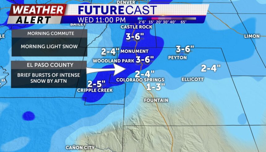
WEDNESDAY: Cold front arrives in the morning with a few bursts of snow along the front. Our morning commute should be smooth; however, brief bands of heavier snow may impact the Pikes Peak region tomorrow afternoon and into the evening. A cold front will sag as far south as the Highway 50 corridor leading to a wide range of temps from the 20s in Colorado Springs to the upper-30s and low-40s around Pueblo. Snow amounts will also vary widely but 2-5" in Colorado Springs is possible and anywhere from a trace to 2" possible for Pueblo.
EXTENDED: Partial sunshine for Thursday and temps in the 30 before a warming trend sets up for the weekend with highs back in the 50's under fair weather skies
