Overnight winter storm makes for challenging roads across Palmer Divide and north Colorado Springs

EL PASO COUNTY, Colo. (KRDO) -- The National Weather Service expects the overnight storm into Thursday to continue impacting traffic through the morning.
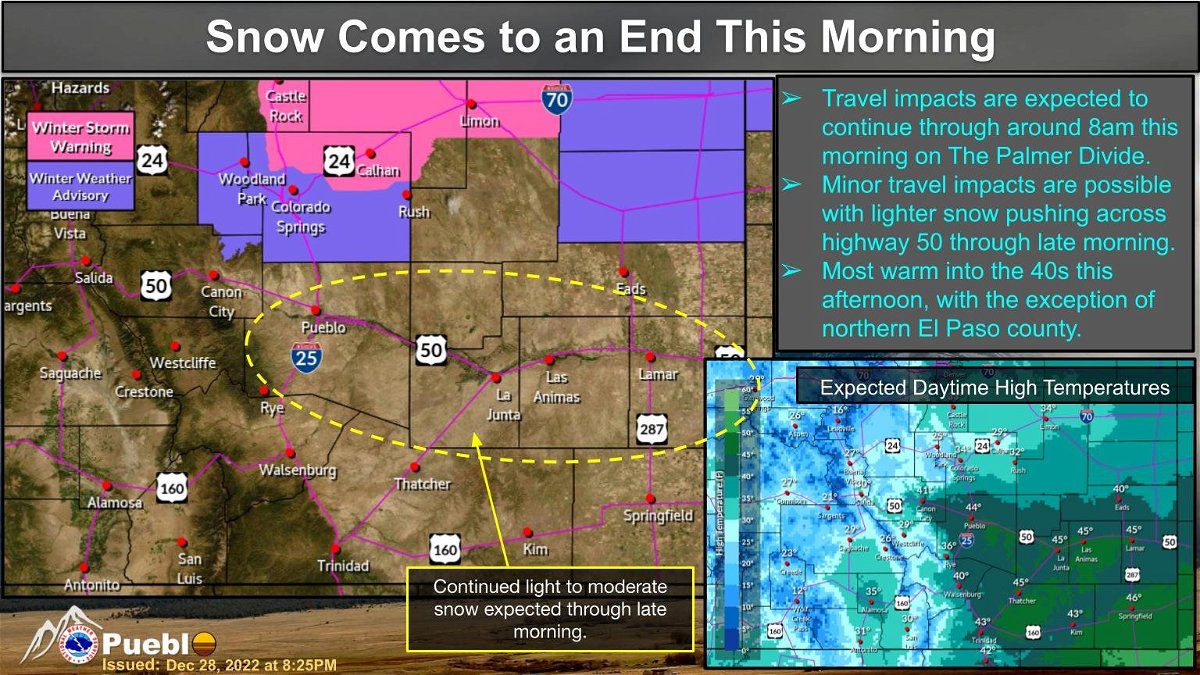
According to the NWS, the impacts will be along the Palmer Divide until at least 8 a.m. with minor impacts expected through the late morning.
It started raining Wednesday evening and that eventually turned into snow after midnight in Southern Colorado.
While the roads might be slick within the city, the further north you go in El Paso County road conditions quickly begins to deteriorate.


Colorado Springs and Fountain were placed on accident alert status due to the snow and poor road conditions.
At 6 a.m., the City of Colorado Springs announced there was a full call out of snow/ice equipment. The city reported the largest impacts were to the northern areas of the city. Due to the heavy snow, officials ask drivers to give themselves extra time on the roads.
Through the morning city crews will focus on clearing primary and secondary roadways, with the largest focus being in the northern areas of the city.
Stay on top of current road conditions through KRDO's traffic tracker here.
For current traffic impacts, click here.