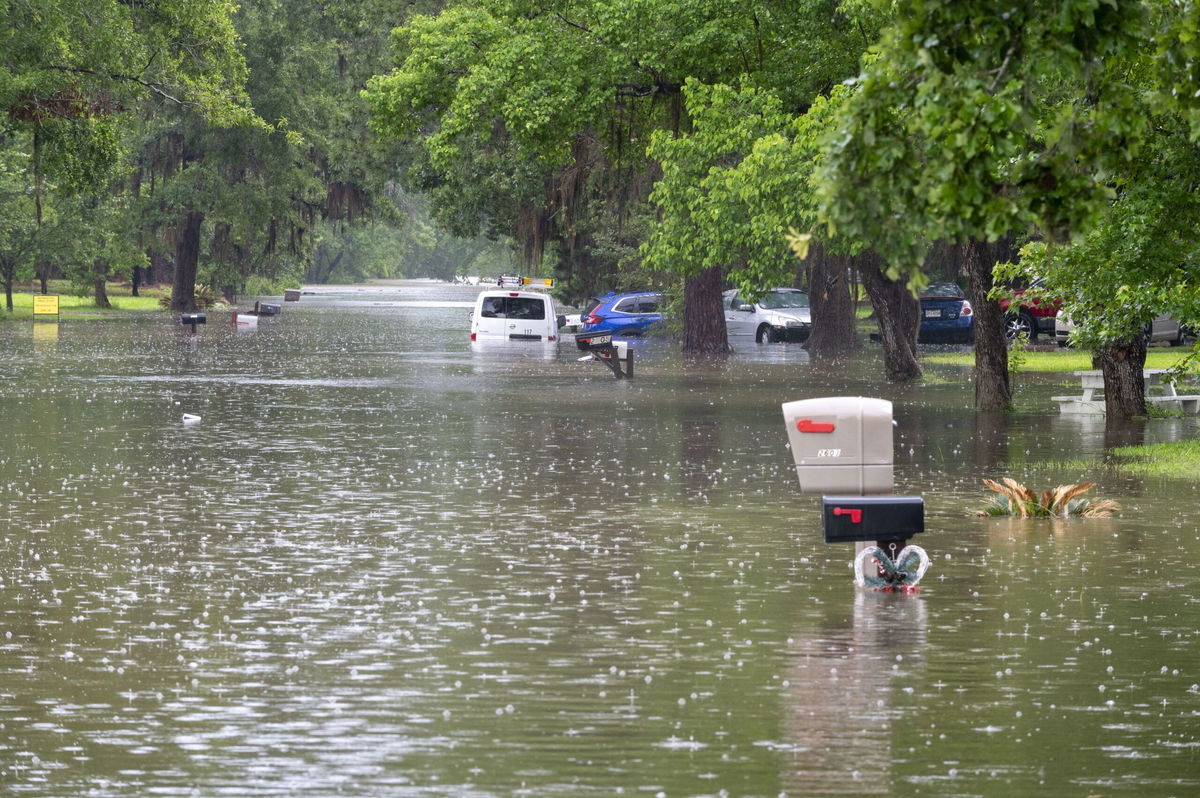
‘Nightmare scenario’ forecast calls for significant flooding in already-soaked Texas and Gulf Coast states

By Mary Gilbert, CNN Meteorologist
(CNN) — Rounds of fierce storms and gushing rainfall are raising the risk of dangerous flooding late this week for millions in the already-waterlogged South.
Double-digit rainfall totals between 20 and 30 inches over the region in recent weeks have soaked the ground and left rivers swollen, priming the flood threat to extreme levels. More widespread heavy rain Thursday and Friday is only going to make matters worse.
The forecast calling for extreme rainfall rates and repeated rounds of storms is creating a “nightmare scenario” for the Gulf Coast, according to the Weather Prediction Center. “Significant and considerable flash flooding is likely as a result, as multiple inches of rain fall in a matter of a few hours.”
A Level 3 of 4 risk of excessive rainfall that could trigger flash flooding is in place from eastern Texas, through Louisiana and into western Mississippi Thursday, according to the WPC.
An upgrade to a rare Level 4 of 4 high risk of flooding rainfall is possible by early Thursday as which areas are most at risk becomes clearer. High risk days are exceedingly rare but account for more than 80% of all flood damage and more than a third of all flood deaths in the US.
Timing out the significant flood threat
Storms, some of which may become severe, are likely to rumble to life Thursday afternoon in parts of Texas and push south and east to reach Louisiana and Mississippi late in the day.
Rainfall rates up to 3 inches per hour are possible in the heaviest storms.
The greatest flooding danger Thursday will come as storms begin to train. Training storms track through and deluge the same areas over and over, like a train pulling its cars over the same stretch of track.
Serious flash flooding is likely in any areas caught under multiple storms unloading 2 to 3 inches of rain per hour. Roadways may quickly become rivers and small streams could easily overflow their banks.
Soaking storms will shift east on Friday and target more of the Gulf Coast.
Much of southern Mississippi and southern Alabama are under a Level 3 of 4 risk of excessive rainfall on Friday. A larger area from the Texas/Louisiana border to Florida and Georgia is under a Level 2 of 4 risk.
Drenching storms from Thursday night will likely last into Friday morning for parts of the Gulf Coast. An initial round of flash flooding is likely in the first half of Friday before rain starts to taper off in the afternoon.
Another bout of heavy rain will develop Friday night and work over the same areas hit earlier in the day. These storms could also produce rainfall rates of 2 to 3 inches per hour, and quickly restart or “greatly worsen” any ongoing flooding, according to the WPC.
Widespread rainfall totals of 2 to 6 inches are expected from Texas into Georgia through Friday night. A few spots caught under multiple torrential storms may pick up more than half a foot of rain.
One of the wettest years to date
The upcoming rain will only add to already impressive rainfall totals in what’s been one of the wettest years to date on record across the Gulf Coast.
Some Southeast cities have recorded more than half a foot of rain above what’s typical for the first several months of the year.
Several dozen cities from Texas to western Georgia are pacing at a top 5 wettest year to date and at least two cities in eastern Texas are experiencing their wettest year, according to the Southeast Regional Climate Center. Dallas is experiencing its third-wettest year to date, while Shreveport, Louisiana, and Jackson, Mississippi, are amid their second wettest.
Excessive rainfall has largely eliminated dryness and drought conditions along the Gulf Coast, but is hasn’t come without a cost.
Earlier this month, nearly 2 feet of rain fell in just five days and sent parts of eastern Texas underwater. Hundreds of people and animals were rescued from flooding as some area rivers rose to levels not reached since Hurricane Harvey in 2017.
The-CNN-Wire
™ & © 2024 Cable News Network, Inc., a Warner Bros. Discovery Company. All rights reserved.
CNN’s Monica Garrett contributed to this report.