WEATHER ALERT: Blizzard conditions Sunday PM through Monday AM
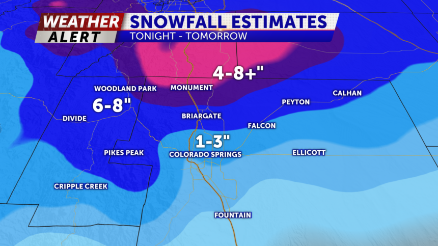
TONIGHT: Energy is spilling over the I-25 corridor, bringing high winds all night, rain showers in the early evening, chances for graupel/hail on your drive north of the Springs, and accumulative snow overnight. 1 to 3" of snow is anticipated around and south of Colorado Springs, with an estimated 6-8" inches for Teller County and the possibility for more than 8" along the Palmer Divide.
MONDAY: Temperatures plummet to the 30s and 40s along and east of I-25 with snow continuing through the morning hours causing dangerous road conditions, then isolated rain and snow are showers possible through early Tuesday evening.
EXTENDED: We dry out and temperatures make a slow rebound back to the 60s in Colorado Springs by Thursday.
