Active Weather Week Ahead
TONIGHT: Increasing clouds and temps in the 20's and 30's. Rain showers tapering off early. Snow showers possible for the Sangres overnight with 4-6" possible.
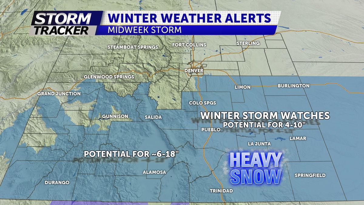
TOMORROW: Mostly dry start to the day with increasing clouds once again. Highs in the 40's with breezy southwest winds. Our next winter storm arrives Tuesday night and lingers into Wednesday morning with heavy snow possible for all areas in southern Colorado.
Winter storm watches in effect Tuesday and continue through Wednesday at 5PM. At this moment, a general 4-10" is expected, but a few adjustments will likely be needed. The current trend is south, with less upsloping for the "snowhole" form PUB to COS.
Road conditions will rapidly decline along and south of the Arkansas river valley by Tuesday overnight and through Wednesday. Blowing snow and reduced visibility possible through Wed morning and Wed afternoon. Snow tapers off Wednesday afternoon. Highs will be cold in the teens and twenties with wind chills near 0°.