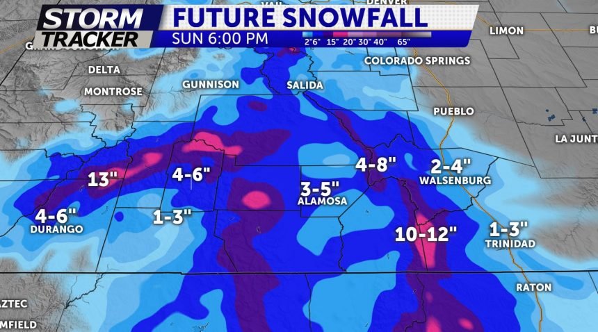
SOME SNOW TONIGHT FOR HIGHER TERRAIN

Snow showers will continue on and off throughout the day with not much more accumulation expected in the lower elevations. Areas above 6,000 feet will likely have better coverage of snow through the day and into the afternoon. Another wave of moisture moves in from the southwest tonight and will impact the San Luis valley and the Wet Mountains tonight. This could bring an additional 3-6" of snow.
For the I-25 corridor from Trinidad to Colorado Springs, rain and snow showers are likely for Saturday as that chunk of energy moves through.
We will eventually begin to clear out in all areas by Saturday afternoon and evening and are expecting a rather sunny day on Sunday with highs reaching back up to normal levels. It won't last for long as we have another storm that we are watching for early next week. For now that is looking to bring more snow to the mountains and more rain and snow showers to the Plains. By midweek, an additional system may roll through and bring some thunderstorms to the region.
In all, it's a busy weather week for Colorado. Stay tuned for all the details and remember, we need this moisture. It helps with our snowpack and drought concerns.
