Light Snow Possible Tonight, More Snow Late Week
Currently, there is a slow-moving disturbance to our west that is yielding gusty winds through 8pm from Pueblo county south to the NM border. High Wind Warnings expire at 8pm.
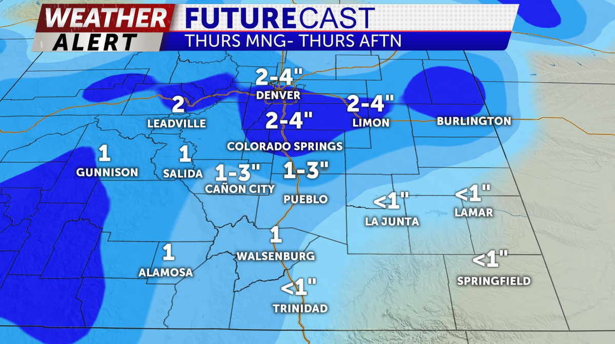
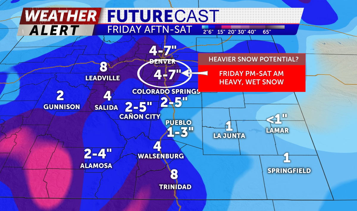
This disturbance will continue to send waves of energy through Southern Colorado keeping chances for more moderate snow in the forecast Thursday-Saturday.
TONIGHT: a chance of rain--> light snow possible overnight with colder temps in the 20's (T-1" possible for some isolated higher terrain areas. )
WEDNESDAY: Skies part on Wednesday with partly sunny skies and highs in the 40's with intermittent breezes out of the northwest around 15-20 mph
EXTENDED: A higher probability of snow begins Thursday morning (around 6-8am)-Thursday evening (wrapping up before 6pm at the latest) with colder temps in the 30's and 40's. A brief break in snow is likely Thursday night-Friday morning before more snow is possible again Friday afternoon (after 1pm) and lingering through Friday night-Saturday mid-day.