WEATHER ALERT: Snow and Frigid Temperatures to Start 2022
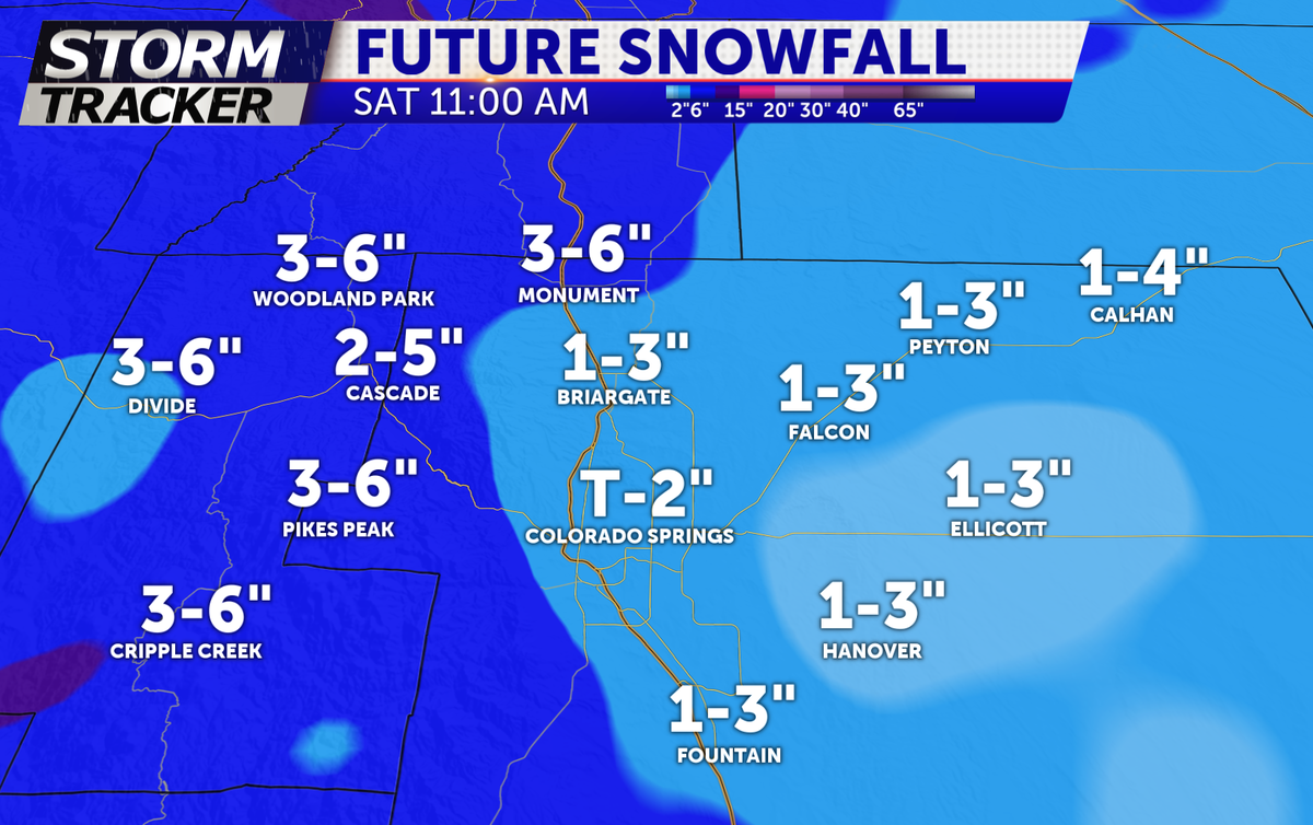
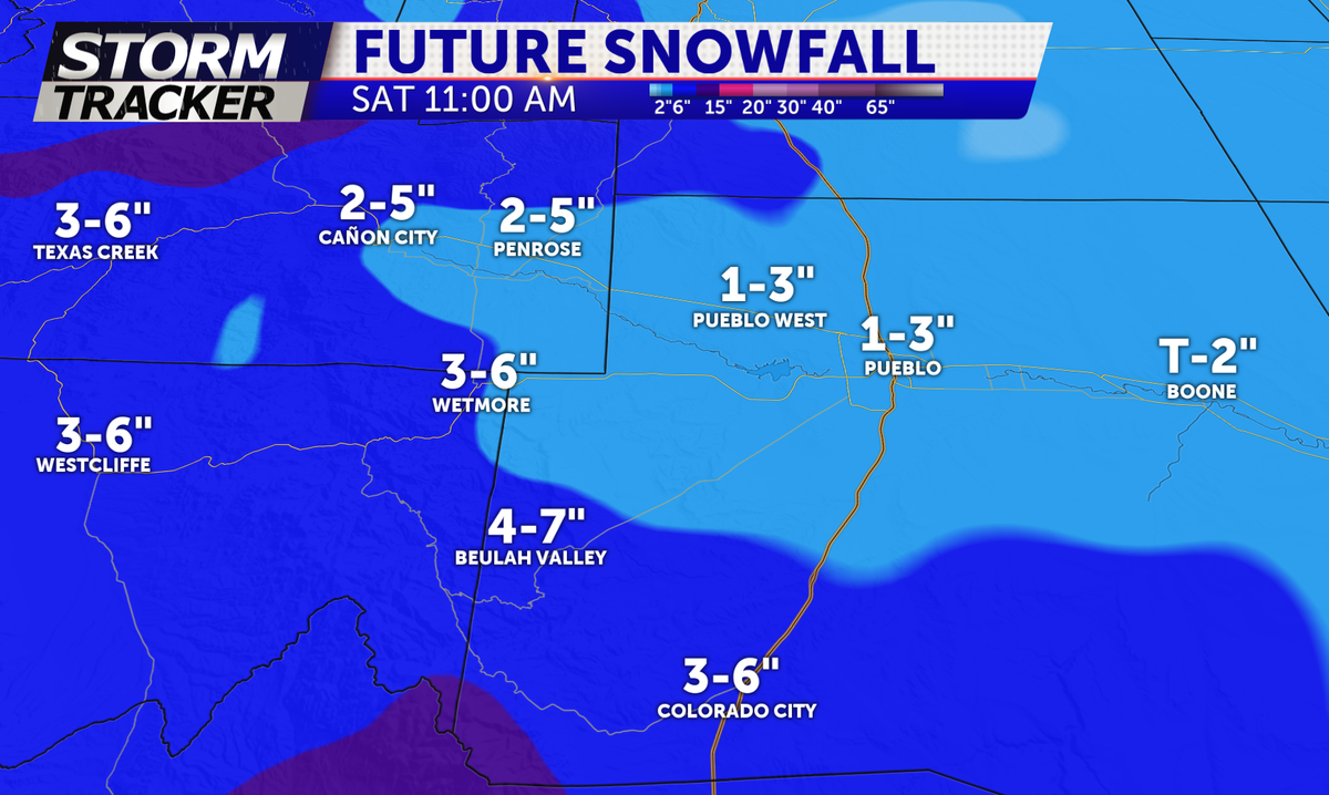
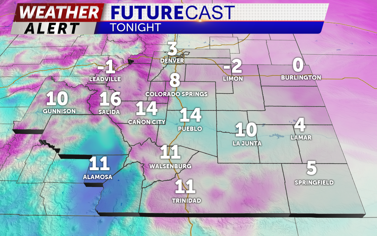
Snow flurries have already begun across the Pikes Peak Region, currently melting on contact with paved surfaces. That will turn out to be problematic through the overnight hours with well below freezing temperatures are likely, along with additional snowfall. Here's the accumulation and temperature forecast through tomorrow morning.


With temperatures reaching into the single digits tonight expect areas of patchy ice under the snow, making for very slick driving conditions through the tomorrow morning. If you have plans to celebrate the New Year, drive carefully.
Saturday staying incredibly cold with highs to 19 degrees in Colorado Springs and 20 in Pueblo with winds at 10-15mph. The snow will gradually taper off during the morning hours with clearing conditions by the late afternoon. Saturday night low temperatures approaching 0 degrees along the I-25 corridor. Finally warming back up on Sunday with sunny skies and temperatures in the 40s.
