Snowy Tuesday Morning Commute
Another cold front is passing through Colorado tonight, bringing moderate snowfall and strong winds tonight and into Tuesday morning. Here is the latest accumulation forecast.
Colorado Springs: Trace-1"
Monument: 2-5"
Woodland Park: 2-4"
Fountain: Trace-1"
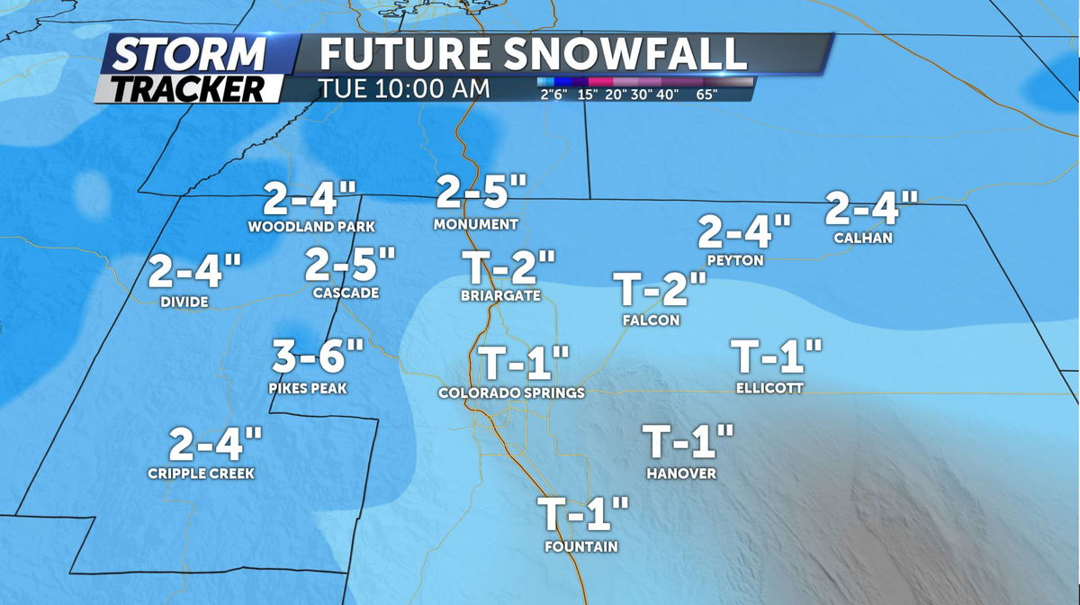
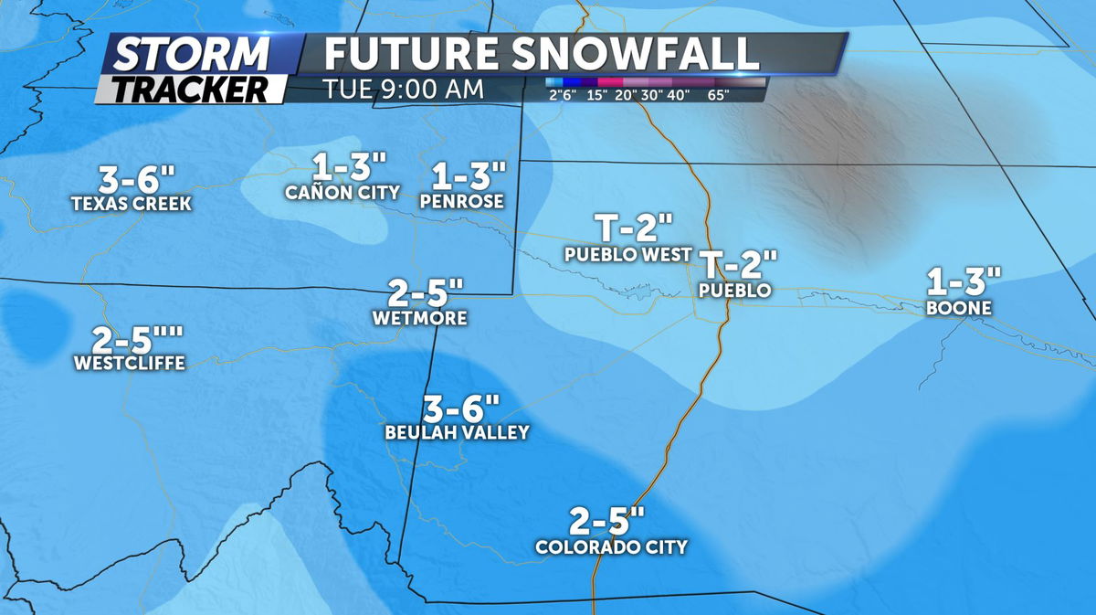
Pueblo: Trace-2"
Penrose: 1-3"
Canon City: 1-3"
Westcliffe: 2-5"
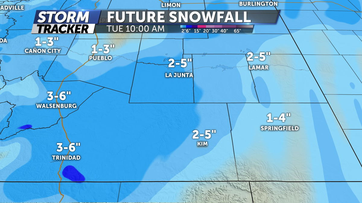
Trinidad: 3-6"
La Junta: 2-5"
Lamar: 2-5"
Springfield: 1-4"
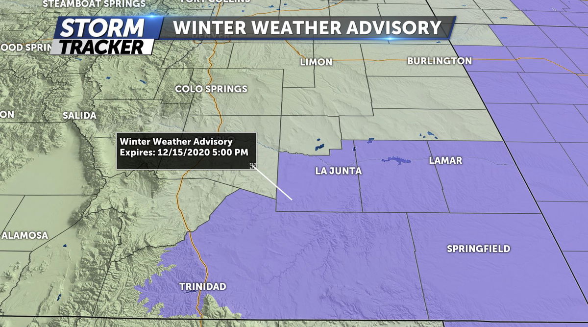
Winter Weather Advisories are in effect starting at 2am Tuesday morning for the southeastern corner of the state. The main concern is not just the snowfall, but strong winds. Gusts will likely reach 35-45mph during the morning hours, blowing snow will cause limited visibility at times.
Colorado Springs although will not see high snow accumulation totals, slick and icy roads along with below zero wind chills are all a possibility. Gradually the snow will exit Colorado from north to south during the mid to late morning, and turn mostly sunny for the I-25 corridor. High temperatures only to 34 degrees in Colorado Springs and 37 in Pueblo.
Clearing conditions for Wednesday and Thursday with highs back into the 40s for most valley locations with another chance for snow showers on Friday.
Click HERE for an interactive radar.
The KRDO StormTracker 13 weather app is available for download in the iOS app store and in Google Play.
