Windy Weekend Ahead
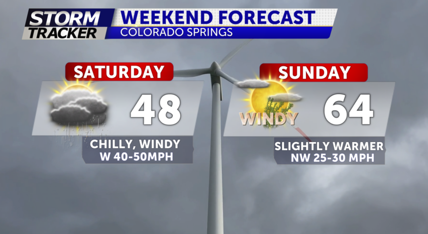
TONIGHT: Much cooler and still windy Saturday. A high wind watch has been hoisted for Saturday into Sunday morning. And we'll see another upper-level low moving across the area Monday night into Tuesday.

SATURDAY: The Front Range Mountains are in for some stronger winds by Saturday. 70-90MPH gusts possible. Mostly cloudy and chilly with highs in the 30's and 40's with a few spotty rain and snow showers for Saturday morning and Saturday evening. Any snow accum confined to higher terrain areas and primarily on grassy surfaces. No widespread accum likely; however, a T-1" can't be ruled out west of I-25 around local mtn cities.

SUNDAY: Clearing out by Sunday but still breezy and chilly with highs in the 40's and 50's, some areas near 60° for the eastern plains.

