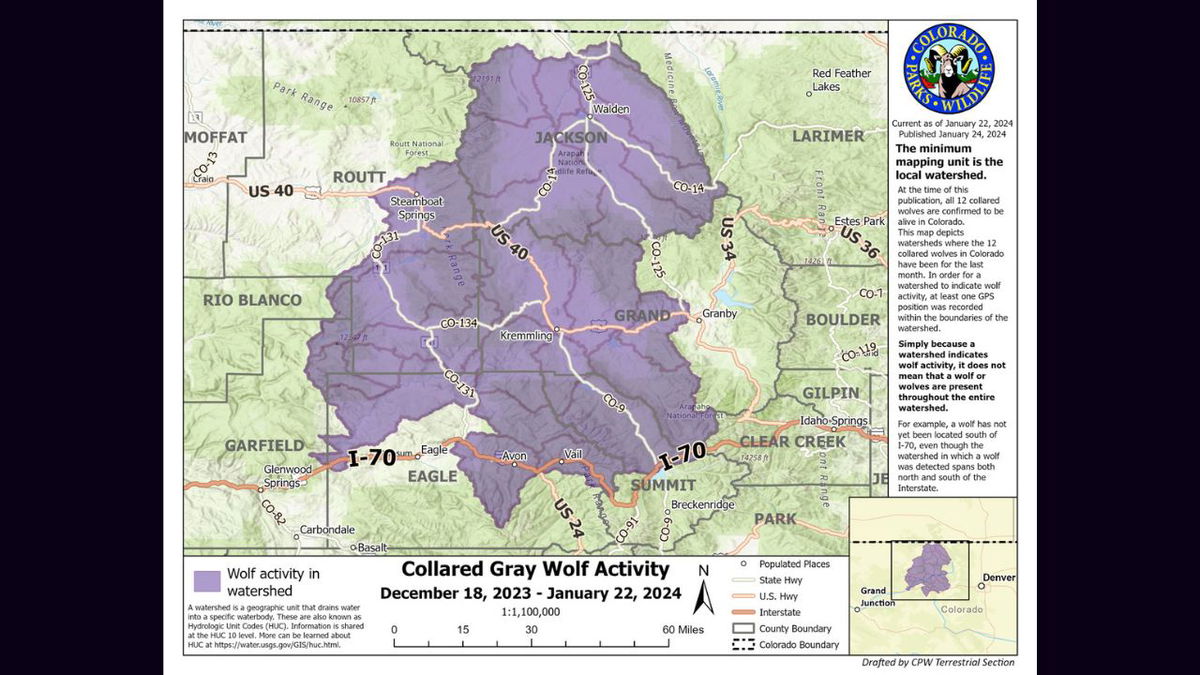
Colorado Parks and Wildlife releases wolf activity map

DENVER, Colo. (KRDO) - Colorado Parks and Wildlife (CPW) announced Wednesday that they have created a new tool to provide information to the public on the activity of gray wolves in the state.
The agency has created a gray wolf activity map that will "help inform the public, recreationists, and livestock producers on where wolves have been in the past month." The agency said the map will be updated with new information on a monthly basis, with updates coming on the fourth Wednesday of every month, "give or take several days." The map will reflect data for the prior month.
Last month, CPW released 10 wolves onto public land in Colorado following a voter-approved initiative that requires the agency to introduce the animals onto the landscape.
According to CPW, the maps are created using GPS collar data collected from all 12 collared wolves in the state. Wolves had already been entering Colorado from Wyoming and two were collared prior to the release of the other 10.
The agency said the GPS collars are programmed to record a position every four hours. Staff can see where the wolves have been but cannot tell where they are at a given point in time, nor can they predict where they will go.
CPW said the maps depict watersheds where the 12 collared wolves in Colorado have been for the last month. A watershed is a geographic unit that drains water into a specific water body. The agency clarifies that in order for a watershed to indicate wolf activity, at least one GPS point from the wolf collars was recorded within the boundaries of the watershed. However, just because a watershed indicates wolf activity, it does not mean that a wolf or wolves are present throughout the entire watershed nor that they are currently in the watershed. For example, the first map released shows that a wolf or wolves were detected in a watershed that spans both north and south of I-70, but according to CPW, a wolf has not yet been located south of I-70.
CPW said it reserves the right to buffer maps that will be shared with the public if doing so protects wolf welfare during sensitive times of the year.
For more information, visit CPW's gray wolf activity map page.
