WEATHER ALERT: Severe storms possible Wednesday afternoon

TONIGHT: Partly cloudy and mild overnight as lows dip into the upper-50s and low-50s.
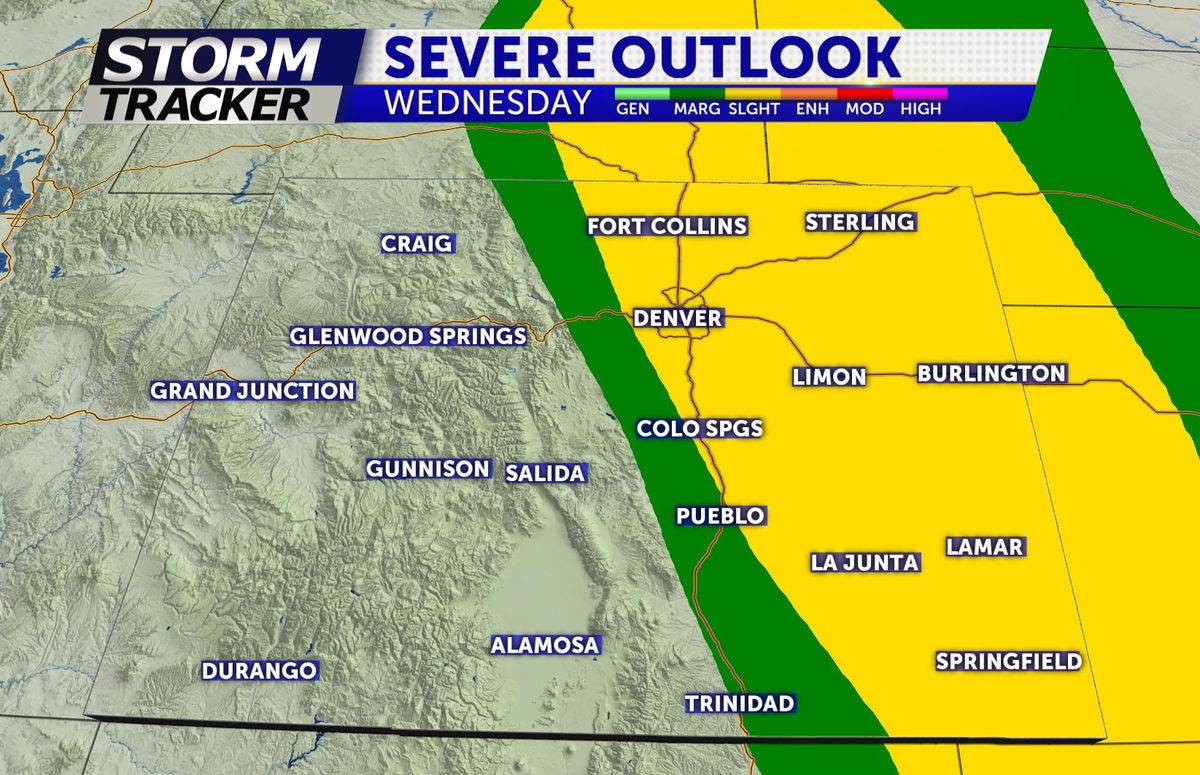
TOMORROW: Severe storms possible Wednesday after 2pm. Primary concern around southern Colorado will be hail (up to quarter size) and gusty winds. The most favorable conditions for hail still look to be east of I-25 but can't completely rule out one or two stronger hail-producing storms around the foothills after 2pm. The northeastern plains of Colorado has the highest tornado potential. Still warm Wednesday with highs in the 70s and 80s.
The graphic below indicates a slight risk for strong-severe storms for Wednesday afternoon-evening. A slight risk (yellow area) means an area of organized severe storms, which is not widespread in coverage with varying levels of intensity is likely
EXTENDED: Unsettled weather and cooler temperatures through the weekend, with a chance for thunderstorms through Sunday. Highs Sunday will max out in the 50s and 60s.
