PATTERN CHANGE MID-WEEK
TONIGHT: Clear and cold with Tuesday morning lows in the low and mid-20s.
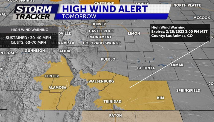
TOMORROW: Gusty winds increasing to 30-40 mph yielding high fire danger along and east of I-25. Temps will be slightly cooler in the 30's to 40's. Strongest winds will be for a few of our southernmost counties where gusts will top 60-70 mph by the afternoon
EXTENDED: Wednesday will be slightly cooler across the region with highs in the 30's. Unsettled weather returns Wednesday night into Thursday morning with snow in the forecast. This may impact the Thursday morning commute. Cold and snowy Thursday... then gradually warmer through the weekend.
