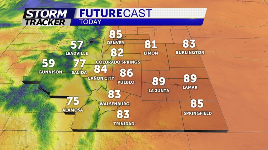
AFTERNOON STORMS NEXT FEW DAYS
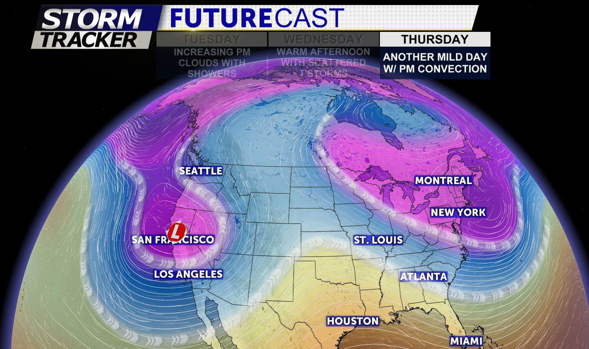
An atmospheric blocking pattern will lead to our isolated storm chance through the end of the work-week
What does this mean exactly? The jet stream pattern in the U.S. this week resembles the greek letter omega which is why this pattern is referred to as the Omega Block (i.e. blocking pattern). The Omega block will keep the low pressure center off the CA coast nearly stationary through Friday. This low will help funnel pacific moisture to the region contributing to our daily afternoon storm chance.
TONIGHT: Clear skies and cool overnight. Morning lows Wednesday will fall into the mid-40s.
EXTENDED: Record warmth possible again Wednesday afternoon with highs in the 80s and 90s. Warm and windy conditions can be expected Thursday... with much colder air arriving Friday with mountain snow and rain showers and thunderstorms across the plains. Chilly temps for the first half of the weekend. Temperatures will warm back into the 60s and 70s by Sunday.
