COLD FRONT ON THE WAY

TONIGHT: Mainly clear with temperatures cooling to the 20s and upper teens. Breezy through the midnight hour.
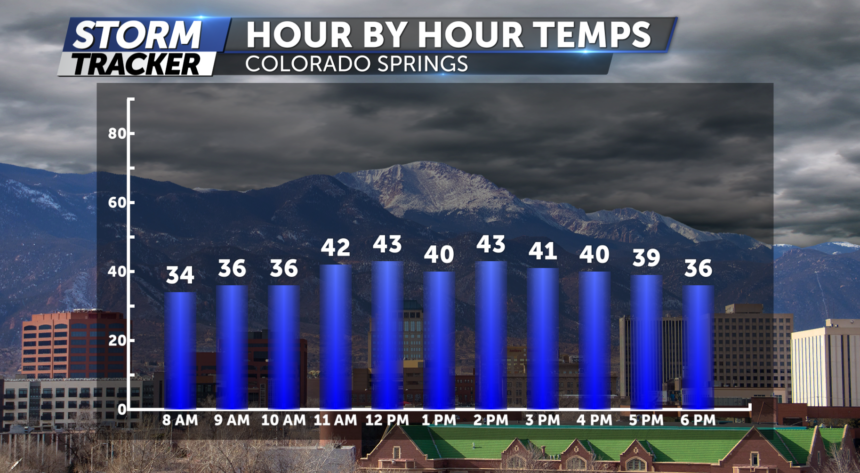
THURSDAY: Clouds increase by the afternoon hours as a cold front moves in only allowing our temperatures to reach the low 40's.
EXTENDED: By Friday morning, snow moves into the Palmer Divide and eastern plains. This will start up around 6am and will continue through the evening. Very minor accumulation is expected. Look for 1-2” or less for areas over Monument hill and our plains cities. Colorado Springs will see about a trace near the downtown area, thanks to drying, north winds.
