Warming Trend This Week

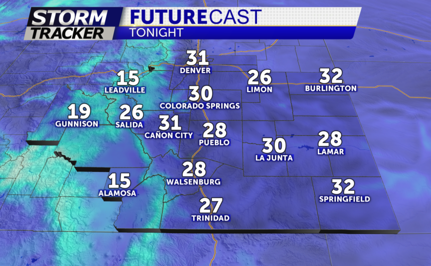
TONIGHT: Mostly clear with chilly overnight lows in the 20's to low 30's.
TOMORROW: After a sunny start, a few clouds will mix in by the afternoon with highs in the 50's to near 60°, with some areas across the eastern plains hitting 70°.
SPRING EQUINOX occurs Tuesday night at 9:06pm MT so technically, our first "full" day of Spring is not until Wednesday! Regardless, Spring is springing this week!
EXTENDED: A slight chance of a few isolated showers for lower terrain areas Wednesday afternoon; otherwise, a mostly dry and calm week ahead is expected. Our next storm system will bring snow to the mountains by the weekend with chance for rain and snow showers for Colorado Springs and Pueblo late weekend and early next week.
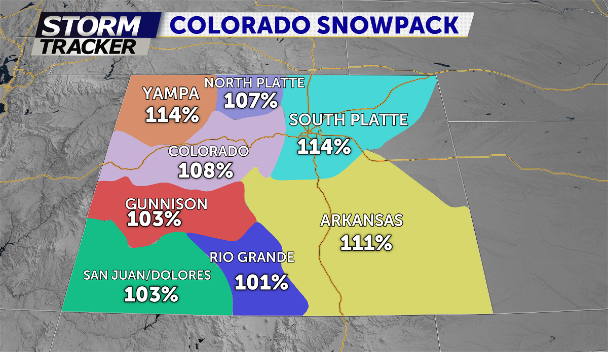
Below is a look at snow-water equivalent for the state of Colorado
Above average for all of Colorado Snowpack after last week's big storm system
100%= average.

