SHOWERS BEFORE 8PM
TONIGHT: Scattered showers and thunderstorms will linger into the early evening hours, and will generally moving across the southeastern plains. Skies will only partially clear as we work towards sunrise Wednesday morning. AM lows will fall into the mid-50s and low-60s around the region.
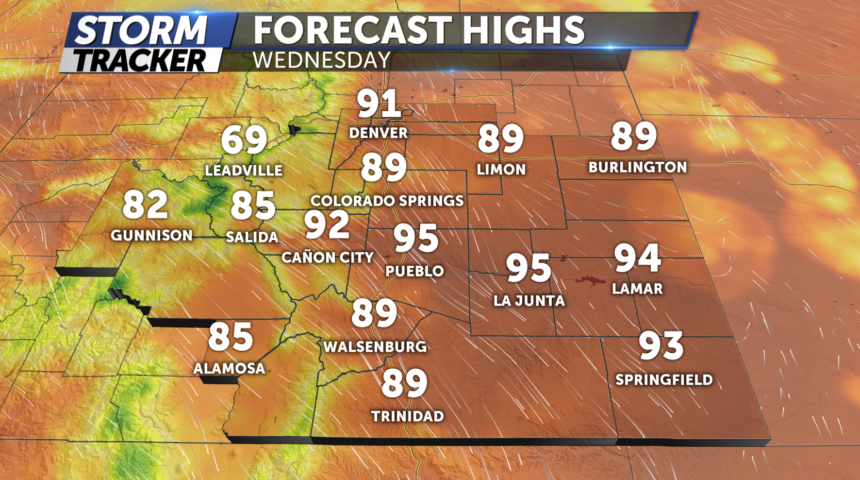
TOMORROW: Partly to mostly sunny skies with highs much warmer in the upper 80's to near 90° for parts of the Pikes Peak region. Isolated storm or two possible after 3pm but expect most locations to stay dry
EXTENDED: The chances for showers and thunderstorms will increase again on Thursday afternoon as energy rides over the top of a ridge of high pressure. Looking at the weekend temperatures will warm into the low and mid-90s by Saturday.
