Cold blows in Tuesday, snow possible later this week
TONIGHT: Partly cloudy and breezy overnight with morning lows Tuesday in the upper-30s and low-40s.
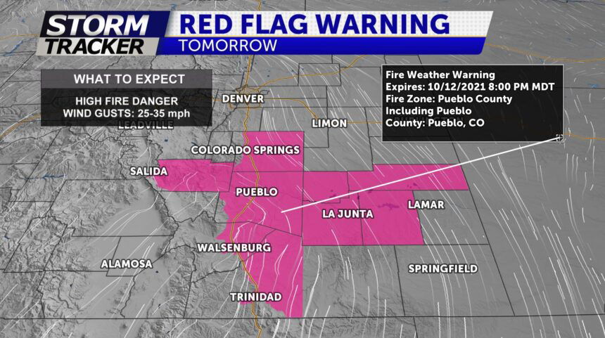
TOMORROW: Periods of sun and clouds and highs in the 50's and 60's for Pikes Peak region. 70's will be felt along the southeastern Plains. HIGH Winds ramp up after 1pm and last until the evening. Gusts could be as high as 60 + mph possible from Pueblo county south to the Raton Pass. Scattered rain showers can also be expected with highs in the 60s across the plains. Snow may be heavy at times in the mountains… especially across the eastern San Juan mountains.
EXTENDED: Colder temperatures at the end of the week with the first freeze possible for Colorado Springs overnight Thursday to Friday morning
