Elevated fire weather returns to Colorado
The relatively weak shortwave energy that brought eastern/central Colorado isolated showers and thunderstorms this afternoon is on it's way to Kansas and high pressure will build across the state through Wednesday.
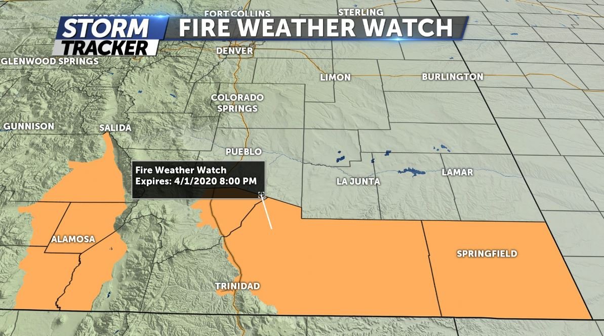
High temperatures Tuesday and Wednesday afternoon will be pushing 10-15 degrees above seasonal averages, into the high 60s and low 70s for the I-25 and HWY50 corridors respectively. Wind speeds may become breezy at times with gusts to 20-25mph Wednesday afternoon, which prompted the National Weather Service to issue a few Fire Weather Watches for Wednesday along the New Mexico border. Minimal precipitation chances for Colorado till Thursday.
A strong low pressure system is currently in the Pacific northwest and will gradually move east across the northern great plains. Cold frontal passage for Colorado residents associated with this system will happen at some point Thursday afternoon, bringing cooler temperatures and precipitation to finish off the work week.
Click HERE for an interactive radar.
The KRDO StormTracker 13 weather app is available for download in the iOS app store and in Google Play.
