Winter weather making a return to Colorado Springs
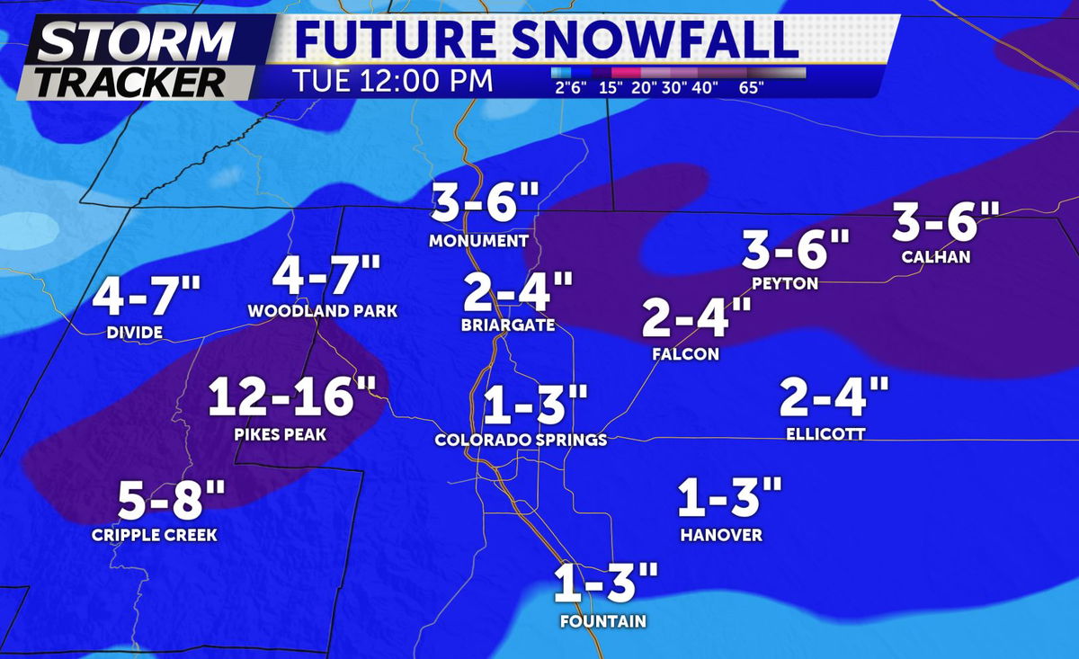
First, here's a look at the forecast snowfall totals for Monday afternoon through Tuesday morning, then followed by storm details.
Colorado Springs: 1-3"
Monument: 3-6"
Woodland Park: 4-7"
Cripple Creek: 5-8"
Falcon: 2-4"
Tonight: Mostly cloudy skies for much of central/southern Colorado with isolated showers during the early evening. A few stronger storms have popped up in central Las Animas County, producing 40mph wind gusts and small hail. Expect the strong storms to be far and few between. Low temperatures down to 34 degrees in Colorado Springs and 39 in Pueblo.
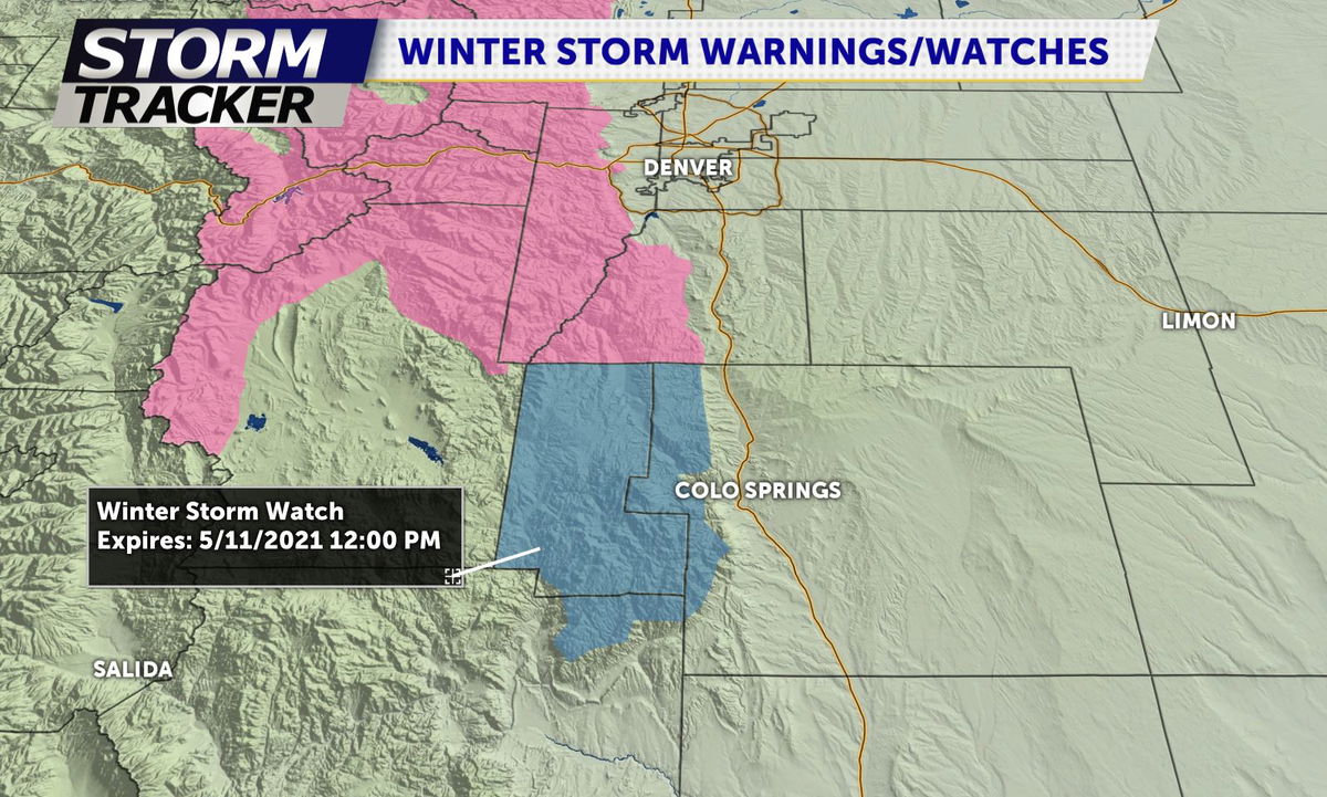
Monday: Rain Showers building in coverage and intensity through the day, with the chance of severe thunderstorms being unlikely. By mid-afternoon, snow showers will develop across the Palmer Divide and into Teller County. Winter Storm Watches and Warnings are in effect along the Rampart Range as areas above 7500ft are favored for higher snowfall totals through this event. Snow levels will drop to around 6000ft after 6pm Monday night, bringing snow into Colorado Springs through Tuesday morning. A good amount of the snow will melt on contact with paved surfaces, but slick and slushy roads are still possible.
Extended: Lingering cloud coverage and rain/snow showers are likely on Tuesday, as the moisture will be slow to exit the state. Gradually conditions will begin to clear on Wednesday with a warming trend through the end of the week.
Make sure to check for changes in the snow accumulation forecast, as we'll make updates to it tomorrow morning.
Click HERE for an interactive radar.
The KRDO StormTracker 13 weather app is available for download in the iOS app store and in Google Play.
