Hurricane-force wind gusts blow through California as part of the ‘bomb cyclone’ hitting the coast
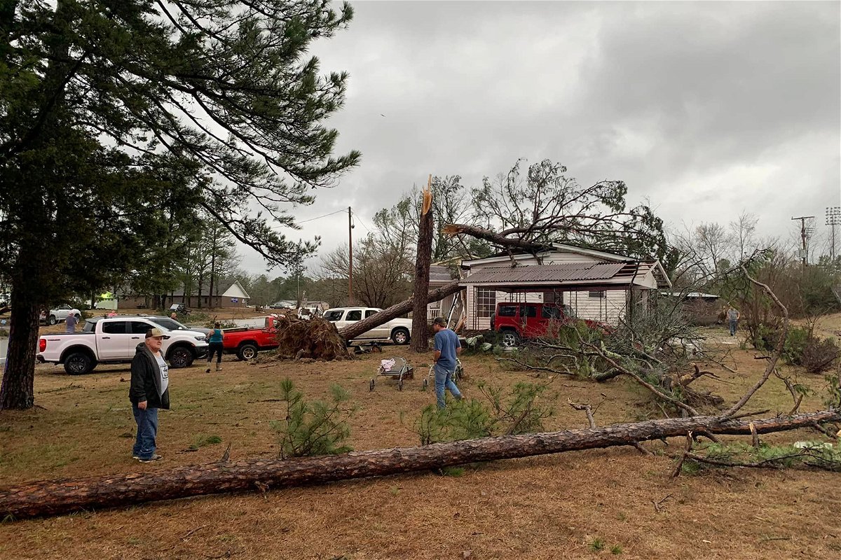
A house damaged by high winds is seen in Arkansas on January 2.
By Amir Vera, Taylor Ward, Rob Shackelford and Jennifer Gray, CNN
Wind gusts in central California have reached hurricane-force as the heaviest rain and strongest winds have begun moving onshore in the Bay Area, all part of another powerful storm — known as a bomb cyclone — that is hitting the state’s coast.
Peak wind gusts along the central California coast so far have been 85 mph in Nicasio Hills and 77 mph in Los Gatos. The strongest winds and heaviest rain with this storm will continue to move onshore this evening.
The National Weather Service is expecting a several hourslong period of moderate to heavy rain and strong winds Wednesday evening. Rainfall rates over 1 inch per hour are possible, which will lead to the potential of flooding, mudslides and power outages.
“The soils are already saturated enhancing runoff and increasing the risk of shall landslides, especially in intervals of heavier precipitation,” the San Francisco National Weather Service office warned.
Areas of central California, including San Francisco, will see 2 to 4 inches of rain and wind gusts over 50 mph Wednesday night into Thursday morning. Higher elevations are expecting even greater rainfall amounts (3 to 6 inches and up to 10 inches in the coastal mountains) and winds continuing to gust near hurricane-force.
Across southern California, including Los Angeles, the heavier rain will move onshore overnight and continue through much of the day Thursday. Widespread rain totals of 2 to 4 inches are likely, with greater amounts in the higher terrain.
“This is the third significant storm system in a remarkable sequence that looks to continue on this weekend and next week,” according to the weather service. The first storm was right after Christmas, followed by the New Year’s weekend storm that brought deadly flooding to California.
San Francisco is now under a flood warning as the brunt of the storm has started to hit the city, Mayor London Breed said in a news conference Wednesday evening. The warning means “floods are inevitable,” Breed said. For most of Wednesday, it was a “quiet day” with some light rain, but in the last hour the rain started to increase, she said.
“It’s coming down hard and it’s not letting up any time soon,” she said. “We want people to stay indoors, we want them to stay home.”
The city saw some localized flooding, a couple mudslides and sinkholes during Wednesday’s lighter rain, said Mary Ellen Carol, executive director of San Francisco’s Department of Emergency Management. An emergency center is currently operating and will stay active for the duration of the storm, she added.
California Gov. Gavin Newsom issued a statewide emergency declaration earlier Wednesday, clearing the way to quickly disseminate aid for those affected by the winter storms wreaking havoc on the drought-plagued state, said Nancy Ward, state director of emergency services, during a news conference.
“We anticipate this may be the most challenging and impactful series of storms to touch down in California in the last five years,” said Ward. “If the storm materializes as we anticipate, we could see widespread flooding, mudslides, and power outages in many communities.”
Evacuation orders have been issued for sections of Santa Barbara and Santa Cruz in preparation of the powerful storm. In Santa Barbara County, which is expecting 4 to 8 inches of rain, mandatory evacuations are in place in some burn scar areas where previous wildfires burned between 2017 and 2021.
“I’m urging folks to comply with the evacuation,” said Das Williams, First District Supervisor in Santa Barbara County. “If you live in that red zone, the one thing that we should’ve learned these past five years is that it’s better to play it safe and to evacuate and comply with the order.”
Meanwhile, a major winter storm that brought snow and freezing rain to its colder northern end — and severe storms and tornadoes on its warmer southern end — is still threatening more severe weather as it treks east.
Bomb cyclone leaves thousands without power
California’s latest dangerous storm is the result of a strong “atmospheric river” — a long, narrow region in the atmosphere that can carry moisture thousands of miles. Northern California and the Bay Area will see the worst impacts through the day Wednesday and Thursday as heavy rain and hurricane-force wind gusts move onshore.
The storm became a bomb cyclone Wednesday, after it rapidly strengthened while still offshore. A bomb cyclone is an area of low pressure that intensifies by 24 millibars within 24 hours. Millibars are a unit used to measure atmospheric pressure.
Stormy weather battering the Bay Area has led to power outages for more than 113,000 Pacific Gas and Electric customers, according to poweroutage.us.
The Oakland Unified School District urged parents Wednesday to pick up children from school as soon as possible once class is dismissed as “heavier rains and higher winds are due in the late afternoon.” One school experienced a short power outage and across the district, “all indoor and outdoor sports, and other extracurricular activities have been canceled this afternoon and evening,” the district said in an email.
San Francisco International Airport has already felt the effects of the strong winds, which have led to a full ground stop at the airport Wednesday, according to an advisory from the Federal Aviation Administration. Departures from the airport were grounded until 3 p.m. PT, the FAA’s website said.
“Departures from the airport are experiencing delays averaging about 15 minutes and increasing,” the FAA’s website said.
Falling glass from a downtown high rise in Fox Plaza was also reported Wednesday, and there were no injuries, according to a tweet from the San Francisco Fire Department.
“It is unknown at this time if this is wind-related — highly possible though,” the department’s tweet read.
Yearslong drought, wildfires and snow contribute to current weather
While those expected rainfall amounts wouldn’t normally have major impacts, the state recently saw heavy rain that left soil saturated and susceptible to flooding and landslides, the weather service said.
Northern California in particular was inundated with heavy snowfall and deadly flooding over the weekend, prompting evacuation orders and water rescues. That raised questions over how much the precipitation would put a dent in California’s ongoing drought conditions.
The first snow survey of the season in the Sierra Nevada Mountains released Tuesday shows the current snowpack is well ahead of average for this time of year, according to a release from the California Department of Water Resources.
The Sierra snowpack makes up about 30% of California’s water needs on average, according to the department.
The snow depth measured Tuesday at Phillips Station, just south of Lake Tahoe, was 55.5 inches. Statewide, the snowpack is at 174% of average for this date, the agency said.
However, experts caution that despite the deluge — and expected precipitation over the coming week — the drought isn’t over yet.
“The significant Sierra snowpack is good news but unfortunately these same storms are bringing flooding to parts of California,” Department of Water Resources Director Karla Nemeth said in a news release.
“This is a prime example of the threat of extreme flooding during a prolonged drought as California experiences more swings between wet and dry periods brought on by our changing climate.”
Because of the yearslong drought, the ground can only absorb so much water and in many areas has already reached its saturation point from storms in late December and over New Year’s weekend. As a result, the influx of water is running off, leading to major flooding in places.
“This is an extreme weather event and we’re moving from extreme drought to extreme floods. What that means is a lot of our trees are stressed after three years of intensive drought,” Nemeth said. “The ground is saturated, and there is a significant chance of downed trees that will create significant problems — potentially flooding problems, potentially power problems.”
The concerns are especially high in areas recently charred by wildfire, where residents are being warned to prepare for possible evacuations.
“We’re also monitoring very closely burn scar areas,” said Nemeth. “If you are in an area that has burned recently, again, we urge you to stay connected with county (Office of Emergency Services). These kinds of events can trigger mudslides and significant debris flow. So be ready to evacuate as needed.”
And the stormy weather isn’t going to let up anytime soon. More rain is expected through the weekend, though the specific impacts aren’t clear yet.
“The message to convey is resiliency as this is not a ‘one and done’ storm,” the weather service in San Francisco said.
Tornado-producing storms push east
Meanwhile, more than 30 million people are under some sort of severe weather threat in the South, with the risk of severe storms stretching from the Florida Panhandle into far southeast Alabama and parts of Georgia and along the East Coast into southeastern Virginia.
As the showers and storms push into Georgia and northern Florida, damaging wind gusts, large hail and tornadoes are possible.
Cities including Tallahassee, Charlotte, Virginia Beach, Atlanta, Raleigh and Norfolk could see winds and tornadoes. Heavy rain could also produce flash flooding in parts of the Southeast.
The multi-hazard storm — which headed into the central and southern US after battering California with deadly floods — has already triggered at least 130 storm reports over the past two days and left a trail of destruction as it barreled across the country, shifting to the South and Southeast.
There have been more than a dozen tornado reports, nearly 100 wind reports and 27 hail reports. The tornado reports included six in Illinois on Tuesday and an EF-1 in Jessieville, Arkansas, on Monday. An EF-1 tornado packs winds of 86 to 110 mph.
Other tornado reports came from Louisiana, Oklahoma, Tennessee, Georgia and Mississippi.
Police in Montgomery, Alabama, were dispatched throughout the night to “multiple locations” in the city in response to “reports of damage due to (a) possible tornado,” the city said Wednesday. More than 50 homes and businesses were damaged following the severe weather overnight, said Montgomery Mayor Steven L. Reed.
There were no fatalities, but one adult with a minor injury was reported, the mayor said.
“It could have been so much worse,” Reed said. “We have to make sure that we’re taking these things seriously and that we understand that, in this time and in this area, we’re going to see more these events.”
A possible tornado touched down in Burke County in eastern Georgia on Wednesday, downing trees and causing damage to some homes and power lines, the Burke County Sheriff’s Department said. Another possible tornado struck just south of Atlanta, in the same neighborhood that was hit by a powerful tornado in 2021.
The storm also brought heavy rain, with much of the South seeing 48-hour rainfall totals between 2 to 4 inches. Some areas across the Mississippi and Ohio River Valley saw up to 6 inches, and isolated areas across eastern Arkansas got 10 inches.
In Tennessee, Memphis and Jackson both saw record-breaking rainfall on Tuesday. Memphis received 3.84 inches, smashing its previous daily record of 2.13 inches set in 1949. Jackson got 2.48 inches on Tuesday, beating the previous daily record of 1.69 inches in 1951.
An extremely warm and moist air mass over the East Coast and Southeast helped fuel the severe weather outbreak. Over 35 daily high temperature records were broken across the eastern US on Tuesday, with the thermometer hitting 81 degrees in Baton Rouge, 77 degrees in Wilmington and 69 degrees in Washington, DC.
Meanwhile, over 5 million people are under winter weather alerts across the Upper Midwest and Great Lakes, where snow and ice accumulations are expected to affect travel, according to the weather service.
Heavy snow is expected across parts of the Upper Midwest through Wednesday, while freezing rain and a wintry mix will spread into northern New England by Thursday, the weather service says.
The storm is expected to gradually begin dissipating Thursday.
The-CNN-Wire
™ & © 2023 Cable News Network, Inc., a Warner Bros. Discovery Company. All rights reserved.
CNN’s Nouran Salahieh, Caroll Alvarado, Melissa Alonso, Paradise Afshar, Joe Sutton, Taylor Romine, Cheri Mossburg and Stephanie Elam contributed to this report.