A FEW ISOL. STORMS WEDNESDAY
TONIGHT: Clear skies and cool overnight, with morning lows dipping into the mid and upper-40s.
TOMORROW: Mix of sun and clouds for the morning with gusty winds around 20-30 mph after noon. Highs will be warmer in the 70's to near 80° along and east of I-25
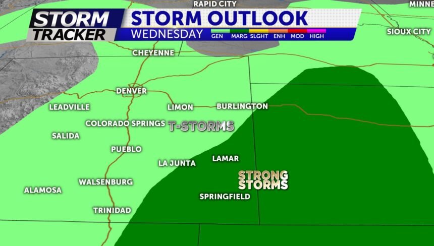
EXTENDED: An isolated severe thunderstorm risk exists for Wednesday afternoon out across the far southeastern plains. Warm temperatures and breezy conditions exist through Thursday with highs in the 70s and 80s. Stronger winds can be expected on Friday afternoon as a trough moves into the region… this will usher in modestly cooler temperatures for this weekend.
