SLIGHTLY COOLER LATE WEEK, MORE STORMS
TONIGHT: Isol storms come to end before 8pm then clear skies and mild overnight. Morning lows Wednesday will dip into the upper-60s.
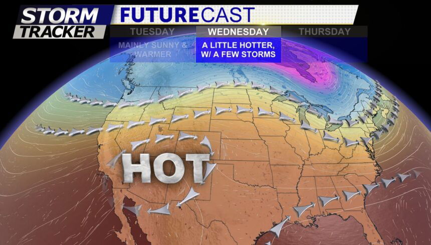
TOMORROW: Hot temperatures Wednesday afternoon, as highs climb into the low and mid-90s. Shower and thunderstorm chances remain low Wednesday but not zero. A few storms still possible around the Palmer Divide and Pikes Peak region after 4pm.
EXTENDED: A nice flow of monsoon moisture will return late week bringing more scattered storms back to the region Thursday as well as slightly cooler temps both Thursday and Friday. Increasing chances for showers and thunderstorms heading into the long holiday weekend.
